The West's fire season has arrived early and hard, and the numbers behind it are sobering.
A season already running ahead
As of late June, dozens of large fires were burning across the Western states, and roughly 3.1 million acres had burned nationwide so far this year — far above the same point in 2025 and above the 10-year average, according to the National Interagency Fire Center, which raised the national preparedness level to 4 out of 5. NIFC described the late-June fire weather as "extraordinarily rare": southwest winds gusting 30 to 60 mph and humidity as low as 5 to 15 percent. More than half of the contiguous United States is in some level of drought, with the Southwest worsening fastest, Drought.gov reported. (Individual fire sizes and containment figures change by the hour; check official sources for the latest.)
A deadly week
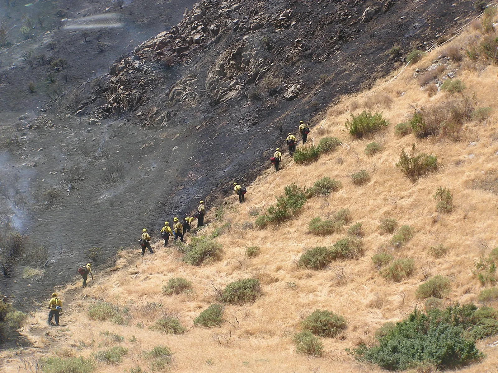
The season's most tragic chapter came June 27 along the Colorado-Utah line, where three wildland firefighters were killed and two others hospitalized battling fires there, NIFC said; details on the cause were not immediately released. Other significant fires have burned in Utah, Arizona, New Mexico and Nevada, several with little or no containment, forcing evacuations and straining crews already stretched thin.
What's driving it
Fire managers point to a convergence of factors: years of drought that have killed and dried out vegetation, a warmer and drier-than-normal spring that cured fuels weeks early, and weather systems pulling hot desert air northeastward with strong winds. Scientists have long warned that climate-driven heat and moisture deficits are pushing the dangerous peak of fire season earlier each year.
The smoke is a health risk
Smoke from the fires has drifted across state lines. Fine particles in wildfire smoke pose the greatest risk to children, older adults and people with asthma or heart disease. When smoke is visible or you can smell it, health officials advise staying indoors with windows closed, running a HEPA air purifier, and wearing an N95 or KN95 — not a cloth or surgical mask — if you must be outside. The EPA's Fire and Smoke Map shows conditions by ZIP code.
How to stay ready
- Track fires: InciWeb is the federal incident site, with maps, acreage and evacuation orders for each named fire.
- Get alerts: register for your county's emergency notifications and know your evacuation zone.
- Prepare a go-bag: medications, documents, chargers and water, ready by the door.
- Harden your home: clear defensible space, keep gutters free of dead leaves, and if told to evacuate, leave immediately — most wildfire deaths happen when people wait.
For California, which has not yet entered its own most dangerous stretch, the early Western season is a warning. When national crews and aircraft are this committed elsewhere, fewer mutual-aid resources are available — and state fire officials are urging residents to use the time now to clear brush and plan ahead.